Our River Witham (1)

This is the third and final article which I wrote for the  Grantham Target in 2015. It’s actually only half of the original, because the second half, covering Lincoln to the outfall at the Wash was omitted. I never did discover who bisected it, nor why. Anyway, this is the whole:

The historic county of Lincolnshire is largely surrounded by water.

To the west, the River Trent rises between Leek in Staffordshire and Congleton in Cheshire, flows eastwards and then northwards, including through Newark and Gainsborough – and meets up with the River Yorkshire Ouse at Trent Falls to form the Humber estuary. The Humber and the Trent form the northern, and much of the western, boundaries of Lincolnshire, respectively.

To the south, the River Welland, rises near Sibbertoft in Northamptonshire and flows meanderingly north- eastwards through Market Harborough, Stamford (there forming a part of the boundary with Cambridgeshire), Crowland and Spalding.  It merges with three other great rivers, the Great Ouse, the Nene and our own Witham, to form the estuary called The Wash which, with the North Sea coast, gives the east of Lincolnshire its distinctive shape.

Granthamians are most familiar with the river which lends so much to Grantham’s visual heritage: the Witham. It rises south of Grantham, a few miles west of South Witham – originally ‘Wytham’. Like that of nearby Wymondham on the River Eye (or ‘Wye’; later the River Wreake, a tributary of Leicester’s River Soar), the name is almost certainly derived from its river – or ēa, in Old English. Ham is an Old English suffix meaning ‘settlement’.

The River Witham flows northwards, little more than a stream, and can be seen easily at School Lane in Colsterworth. After this it passes under the A1, flows through land attached to Easton Hall, under the pretty humpbacked bridges at Easton Lane and at Great Ponton – then through the grounds of Little Ponton Hall.

New Somerby is where the now quite substantial Witham enters Grantham (there’s –ham again!). This is also where the town’s imminent, so-called southern by-pass, from the Somerby Hill roundabout towards the A1, will be carried over the Witham valley by a high-level bridge.

In the town, the river’s first easy visual access is at the pool at the picturesque Spittlegate watermill which faces the bottom of Harrowby Road. A few yards on, it passes under the Bridge End Road bridge, the first of several viewpoints in Grantham. Later views are had from the bridges at St Catherine’s Road and Avenue Road; from the well-known ‘White Bridge’ in Wyndham Park, where it meets the culverted end of the Mowbeck (whose source is at Harlaxton) coming under the town from the west; and lastly from the Belton Lane bridge.

The higher ground between the Witham to the east, and the Mowbeck to the west and north, was where the Saxon settlement of Grantham grew up. The water supply enabled the wool-, and later leather, trades to flourish in mediaeval, and early modern, Grantham. Two watermills which provided flour for bread-making were driven by the River Witham.

A riverside footpath now links the Bridge End Road and Belton Lane bridges, initially on alternating sides of the Witham, before leaving it at the weir-footbridge in Queen Elizabeth Park for Manthorpe Road. This stretch of river is looked after by Grantham Rivercare, which is led by fellow Civic Society committee member, John Knowles.

Once past the back of Manthorpe old village, and near to Londonthorpe Mill, the Witham is joined by the Withambrook, a substantial stream which hasn’t come far from its source near Harrowby Hall via Alma Park.

On the north edge of Grantham, the Witham forms a very attractive setting in Belton House grounds and Belton village. Perhaps the last places in the Grantham area from which it can be seen easily are Marston Hall (home to the late Henry Thorold, the historian who wrote so much about Lincolnshire) and Marston village. For three miles at Claypole, it forms the boundary between Lincolnshire and Nottinghamshire. South of Lincoln, the Witham meanders through numerous small villages – including Aubourn, where it forms a superb background to the Hall’s famous rose gardens. It then enters the city from due south.

From North Hykeham, the Witham runs parallel to, and west of, Lincoln’s High Street (B1262), northwards. In the city centre it meets the Roman-built Fossdyke Navigation (coming due west from the River Trent at Torksey) and forms the picturesque Brayford Pool. From here, it swings sharply eastwards through the ‘Glory Hole’ underneath the famous High Bridge (which dates from Norman times), after which it is navigable. In mediaeval times, the ability to import goods up-river, and for goods made in Lincoln to be exported through Boston, benefitted both settlements.

In times of very high water, the ‘Glory Hole’ is unable to take the volume, and the excess is diverted away from the city by the Sincil Dyke (later, South Delph) to rejoin the river near Bardney. The Witham passes under the Lindum Road before heading away from Lincoln.

The mooted Lincoln eastern by-pass will cross the Witham between Washingborough on the south bank (where the river swings southeastwards) and Cherry Willingham on the north. Until that time, the next crossing-point is still the iron bridge at Bardney (built in 1893-4 on the B1202), which is overlooked by the village’s sugar-beet factory.

After it passes Southrey and Kirkstead, the Witham (now a major watercourse) crosses, still southeastwards, vast swathes of drained fenland. Before Tattershall Bridge, it is joined in quick succession by Timberland Delph (from the west), the Horncastle Canal (east) and Billinghay Skirth (west). At Tattershall Bridge itself, where the elegant old brick pack-bridge is almost hidden, the by-now high-banked Witham passes under the ‘new’ A153 road-bridge – and this is a great place to sit and watch it saunter elegantly past!

Close to the Battle of Britain memorial Flight, the Witham is joined by the River Bain from the north, just before it splits Dogdyke village. A mile later, at Chapel Hill, it is joined from the west by Kyme Eau, which Sleafordians know as the continuation of their River Slea. From here to Langrick, the Witham was straightened in 1833.

Our river flows under Langrick’s steel bridge (built on the B1192 in 1909) towards Boston. It passes under the Skegness railway and through the Grand Sluice; then enters Boston proper under the magnificent new St Botolph’s footbridge and the famous Town Bridge (all overlooked by the Boston ‘Stump’) and, lastly, the Haven Bridge on the A16.

Just after the Haven Swingbridge, the Witham, now called the Haven, is joined by the South Forty-Foot Drain (or Black Sluice Navigation; from the west) and by the Maud Foster Drain (from the north). Lastly, the Hobhole Drain joins from the north, just before the river makes its grand exit into the westernmost point of The Wash. It has done this for a thousand years: the outflow was originally at the extinct village of Drayton, now part of Skirbeck, until in 1014, heavy flooding forced a route-change.

Between South Witham and The Wash, the River Witham ambles and saunters for 82-miles. Curiously, in that journey, it moves only 30 miles eastwards from Grantham – but includes a 52-mile detour!

In a second article on the River Witham in Grantham and surrounds, I hope to give an account of the natural heritage and wildlife of the river.
Lincolnshire and 2015 Anniversaries

This is another article which was written for the Grantham Target, back in 2015:

This year sees several major anniversaries of great note in the history of the British Isles. Four of them are described here.

Exactly eight hundred years ago, on 15 June, a water-meadow by the River Thames in Surrey, became one of the most famous places in the history of the western world. The meadow, called Runnymede (‘meeting meadow’ in Saxon) is where King John (1166-1216) agreed with 25 or more of his barons (several of whom had connections to Lincolnshire) to the signing of a ‘peace treaty’. Drafted mostly by the Lincolnshire-born Archbishop of Canterbury, Stephen Langton (c.1150-1228), the document was intended to protect certain rights of the barons. It is a widely believed fact among pub quiz aficionados that John could not read, and that his ‘signature’ was actually his seal.

The king did not abide by the ‘treaty’, and it was also decreed void by Pope Innocent III. The barons invited the son of the French King, Prince Louis, to become king of England. Even after John’s death, the ‘Barons’ War’ continued, culminating in the Battle of Lincoln in May 1217, when the forces of the boy king, Henry III (1207-1272), led by Dame Nicola de la Haye, Constable of Lincoln, held the castle against the prince and the rebels.

After this, the document was re-written and re-issued in 1216 and 1217 – and only then became known as Magna Carta, or Great Charter, to distinguish it from a similar Charter of the Forest.

Some thirteen copies – or exemplifications – were distributed around England, but only four of these originals remain in existence: two in the British Library, one in Salisbury Cathedral and one (now) in Lincoln Castle. The Lincoln copy almost certainly passed through Grantham on what became the Great North Road, on its way to the cathedral.

Many people – including early American settlers – considered Magna Carta to be the embodiment of modern law, but apart from the fact that it enshrines the right of all to access to the law, this is mostly myth, and it generally had very little to do with that modern institution, the common people.

Exactly two hundred years later, another event occurred which would change the course of English history – although this time not on English soil. The then king, Henry V (1387-1422), was the grandson of the First Duke of Lancaster, John of Gaunt (or Ghent, in Belgium, his place of birth) and son of Henry IV – who was born in Lincolnshire at Bolingbroke Castle, near Spilsby, and which is now a ruin.

A long-running war, the so-called Hundred Years War, had already been waged between the houses of the Plantagenet and Valois for over seventy years, when The Battle of Agincourt took place on St. Crispin’s Day, 25 October 1415. Here, near the village of Azincourt (some 36 miles from Calais), Henry V of England roundly beat the much larger army of France’s Charles VI (who did not participate). Subsequently Henry went on to marry Charles’ daughter, Cathérine de Valois, and their son became Henry VI.

Exactly four hundred years after Agincourt, a third great event occurred which changed the history of much of Western Europe: the Battle of Waterloo.

Following his defeat in the Peninsular War (1807-1814), Emperor Napoleon Bonaparte (Napoleon I) was exiled to the Tuscan island of Elba. However, after eight months, he was able to return to France and to power. He and his army were finally defeated on 18 June 1815, near the village of Waterloo in what is now Belgium, by several armies of the Seventh Coalition, led by Arthur Wellesley, the first Duke of Wellington (1769-1852) – together with the Prussian army, led by Field Marshall Gebhard von Blücher.

Among those who fought under Wellington were the soldiers of the 2nd Battalion 69th (South Lincolnshire) Foot which recruited widely in Lincolnshire. The 30th Foot (Cambridgeshire) recruited from Kesteven, including Sleaford from 1779 to 1829, and from Grantham from about 1811 onwards. The roll-call of the 30th at Waterloo contains some surnames which are still familiar to us now, including Blackburn, Cant, Foster, Gregory, Kirk, Muxloe, Ramsden, Stennett and Ward.

Napoleon died – in exile again – on the South Atlantic island of St. Helena, in 1821, aged 51.

Exactly fifty years after Waterloo, our fourth event occurred. This was not a battle, but the publication of probably the most well-known children’s book to have been written in the English language: Alice’s Adventures in Wonderland. Written by Charles Lutwidge Dodgson under the anglicised Latin version of his name, Lewis Carroll. It was published by Macmillan on 26 November 1865, with illustrations by John Tenniel.

Alice in Wonderland, as the book has become in common usage, is the story of a young girl, who falls down a rabbit burrow while chasing after a talking White Rabbit and then has several magical adventures which involved other fantastic creatures, such as the Mad Hatter, the Cheshire Cat, and the Queen of Hearts. These have all since passed into our language.

The book was an immediate popular success – so popular that Dodgson wrote a rather less successful sequel in 1871: Through the Looking-Glass – and What Alice Found There (also illustrated by Tenniel and also published by Macmillan). Similarly fantastic creatures occur here: Tweedledum and Tweedledee, the Walrus and the Carpenter, and the White and Red Queens.

As well as being a mathematician, an author and an illustrator, Dodgson was a photographer: one of his portrait sittings was of the Lincolnshire-born Poet Laureate, Alfred, Lord Tennyson. He never stopped in Lincolnshire as such, but almost certainly passed through Grantham on his several journeys to Whitby.

Many thanks go to Carole Divall for her help in the preparation of this article.

David Feld


Whatever Became of… Christian Salvesen?

The following was an article which I put together back in 2015, for the unfortunately now-defunct Grantham Target:


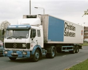
Forty-odd years ago, I spent two summers working as a quality controller for Christian Salvesen at the company’s Ladysmith Road site in Grimsby. I had no inkling that our paths would cross again and merge for a large chunk of my adult life.
The Salvesen site at Easton, eight miles south of Grantham on Ermine Street (B6403), was chosen originally for its operations because of its closeness to the A1 and therefore easy access to rest of the UK road network. Salvesen Easton was well known to very many Granthamians who have worked there over the years. Indeed, at any time during its heyday, some 400 people were employed there. Employees were shepherded to and from the town and outlying villages by coaches which ran four times a day.
In 1983, the decision was made by Salvesen to re-locate its Central Laboratory from its head office in Edinburgh, so that it would be nearer to the main pea-growing area of England: Lincolnshire and East Anglia. The chosen site was Easton. A large section of the main office was partitioned off, and a six-room laboratory complex built within. Clockwise, the rooms were: Microbiology, Preparation, Food Technology/General Office, Chemistry, storeroom and the manager’s office.
Easton’s Central Laboratory remained operational until 2001 when the whole department was closed and the staff made redundant. For the 17 years of its existence, the period during which I was employed as Company Microbiologist, the laboratories serviced 11 processing sites around the UK, from Felixstowe to Dundee. Those sites sent samples by refrigerated transport – often the company’s own distinctively-liveried, articulated vehicles – for testing. Results were usually posted back to the other sites within two days. During the ‘pea season’, the numbers of samples grew substantially and temporary technicians were drafted in.
As a department, Central Laboratory was also there as a centre of information and excellence. Customer complaints, such as foreign bodies which were allegedly found in products, would be examined and comprehensive reports sent back to customers. It was also necessary to troubleshoot on occasion: this could mean investigating anything from mouldy cabbages or carrots in our chill-stores to contaminated meat, ammonia-leak-damaged products and rodents (the site was in the middle of nowhere, after all).
The original company of Christian Frederick Salvesen (1827-1911) was a shipping concern which operated out of Leith, near Edinburgh, and Stavanger. The company’s house flag was the Norwegian flag with its colours inverted. In the 1880s, the company became involved in whaling, with two factory-ships operating out of South Georgia in the South Atlantic Ocean. The whaling station there, named Leith Harbour, was abandoned in 1965 – and it was here, 17 years later, that Argentinean navy invaded the British territory, making its mark by throwing stones at windows of the abandoned buildings.
After World War II, whaling became unfashionable, and Christian Salvesen (the company) moved into deep-sea fishing. In order to cope with the harvest, the largest coldstore in the world was built in Grimsby, at Ladysmith Road. It might be the largest still. From fish, Salvesen expanded into frozen vegetables. This is surprising to many people who, when told, had previously thought that it was just a haulage company.
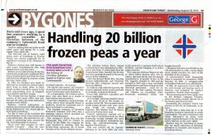
At its height, Salvesen handled about 80% of all of the frozen vegetables in the UK. This included about 10,000 tonnes of peas each year; since peas weigh, on average, about 0.5grams, this implies that 20 billion peas were frozen every year – or, in the17 years of my tenure, over a third of a trillion! Many of these no doubt found their way onto Grantham dinner-tables, having been supplied to leading food chains.
Central Laboratory carried out a great deal of analytical work for what eventually became perhaps the most successful subsidiary: Dawnfresh Seafoods, the seafood-processing side based at Whitehaven. This was bought out by Alastair Salvesen in the early 1980s and eventually moved to a purpose-built site at Bellshill, outside Glasgow; it is still a going concern. The laboratories also took in work from other companies across the UK, including manufacturers of sandwiches, ice cream, fish, and cooked meats and pâtés.
The company did have fingers in other, albeit rather diverse, pies. For instance, Salvesen Brick was the largest manufacturer of quality bricks in the UK; Aggreko (bought in 1984 and demerged in 1997) was a very successful manufacturer and hirer of large mobile electrical generators – used, for instance in the 2012 London Olympics; and Vikoma, an oil-spillage retention-boom subsidiary which was bought from BP, was – and still is – also very successful.
Christian Salvesen was floated on the UK stock market in 1986, a move which many would consider the start of the downfall of the company; it was certainly the end of what had been a much-loved family concern for many years. It overstretched itself financially when it acquired its competitor, Swift Services in 1993. A company-wide re-branding followed soon afterwards.
In 2007, an aggressive buyout bid for the cold storage and haulage parts of Salvesen was launched by another competitor, Norbert Dentressangle – of which it is now a wholly-owned and completely subsumed subsidiary. The processing parts were taken over by the Belgian company, Pinguin, which has more recently moved out of the Easton and Bourne sites.
Essentially, the company which was started in 1872 by its namesake, is no more. It will take a long time for it to be forgotten, however, especially in south Lincolnshire. The site at Easton is still called ‘Salvesen’s’ by many local people, even when they’re referring to PAS – despite that part of the site having been sold to McCain in the early 1980s!
Readers may be interested to know that my small collection of Salvesen ephemera is available and housed in Grantham library.
David Feld, 2015.07.09

Food Plants

Finally, I finished my paper, ‘A Systematic Checklist of Food Plants of the World,’ and uploaded it on to Academia.edu!

The paper took c.30 years, on and off.

It was started as a project at Christian Salvesen, where I was Company Microbiologist and general scientific dog’s-body, doing a lot of foreign body identifications: many of them were of plant origin.

I did well over 1,000 reports – which were all destroyed by the recently-new Laboratory Manager (who hadn’t got a clue) when the department was made redundant in 2001.

The paper is available here:

https://l.facebook.com/l.php?u=https%3A%2F%2Fwww.academia.edu%2F45570475%2FA_Systematic_Checklist_of_Food_Plants_including_Herbs_and_Spices_and_with_an_Index%3Ffbclid%3DIwAR3dt2BB24Lfr2LqCJ3eypRSBuHUA-xiPEp_RH8yUOlK-Yl18dHexPjHGGI&h=AT3Rpbn7H0Mw1SoTKW7fhRgzaEJGG7Fv4-wePWewK-gZQnyOXEJ4cF1c-2heCCV3UTaeYLxzfN-ZezA0ucjo6xnhllUzGtTeL9lyKSMwKejnTrgTBzS1IgRNVWtzpJBOpw&__tn__=R]-R&c[0]=AT1t2zDDt6mZetjawOgjYULBoBCQrGHPsWPQVGaBM0bwIwDY4BQxTDeQGpk596qZmdm7tEROzb9q8lX7foNjrNg8DClBB8PZdMKmSqi6EGvZs-t5lXYf_jXRb2BJZRmQWLeTkeSqLgXna-o-U4qb